


Buying land for a barndominium starts with a usable building envelope
Before buying land for a barndominium, verify that the parcel can accommodate the actual residential and shop uses, lawful access, utilities, wastewater needs and a practical building location. Acreage alone does not establish buildability. Treat a promising listing as a candidate for investigation, then assemble parcel-specific evidence before accepting an irreversible purchase obligation. The useful outcome is a realistic site concept and a list of resolved conditions, not simply a parcel large enough to contain the shell outline.
Start with the intended use in ordinary language. Describe a permanent residence, number of proposed sleeping rooms, attached or detached shop, vehicles, equipment and any paid activity. Include future intentions that could materially affect the land decision, such as another dwelling or business expansion. The property investigation should test those uses rather than the loosely defined word barndominium. A county employee cannot reliably evaluate an activity that the buyer has not described.
Create an evidence ladder for each important statement. A listing phrase such as utilities nearby is a lead to investigate. A provider conversation adds information. A written service response tied to the parcel and proposed load is more useful for project planning. Likewise, a rough online parcel outline is a starting reference rather than a professional boundary survey. Record the source and limits of each fact so uncertain information does not become a design assumption by repetition.
Texas A&M AgriLife Extension's rural land purchasing checklist highlights access, utilities, conveyed rights, easements and title review as important purchase considerations. Its Texas context does not establish a nationwide legal process, but the categories provide useful questions for a buyer to discuss with qualified local professionals. Keep the answers specific to the parcel being considered.
Confirm the parcel, boundaries and legal access
Use the legal description and parcel identification consistently across the title work, survey, planning inquiry and utility requests. A street address or a pin placed in a listing can be insufficient to identify the exact land offered. Ask the appropriate property professionals to reconcile differences in acreage, boundaries or road frontage. Do not treat a fence, worn track or neighboring owner's statement as conclusive evidence of the legal boundary.
Investigate legal access separately from physical access. A visible road may be easy to drive while the right to use it, improve it or bring construction traffic remains unclear. Ask the title professional or attorney what documents establish the intended access and what restrictions apply. If the route crosses other property, understand the actual recorded rights and obligations rather than relying on a handshake arrangement described by the seller.
Then inspect the physical route with the project in mind. Ask about delivery vehicle access, turning, overhead obstacles, drainage crossings and seasonal conditions. A route suitable for a passenger vehicle may need a different review for construction deliveries or emergency access. Confirm which authority controls driveway entry and which improvements require permission. The point is to identify dependencies before the supplier arrival date is fixed.
For private or shared roads, ask who maintains the surface, drainage and crossings and how responsibilities are documented. Discuss ordinary household use and the proposed shop traffic accurately. The buyer should know where the legal review ends and the engineering or access review begins; neither document automatically answers the other question. A workable plan needs both an appropriate right to reach the site and a route suitable for the intended project.
Keep the access line visible on the site concept. It occupies space and may influence the preferred building orientation, parking and utility routes. If access forces the shop door onto a particular side, carry that constraint into the floor-plan study. This avoids choosing the interior arrangement first and discovering later that the vehicle approach cannot serve it conveniently.
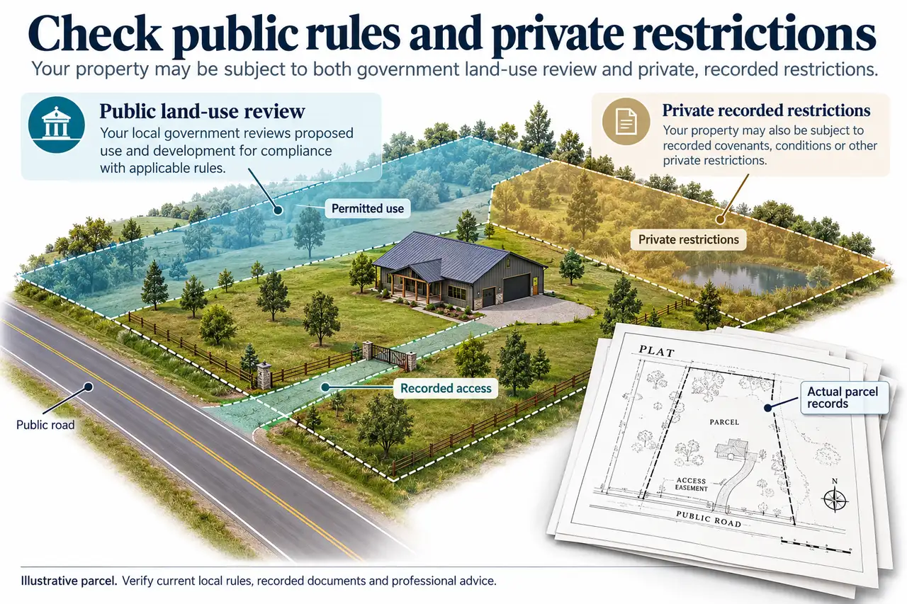
Ask zoning about the uses, then review private restrictions separately
Contact the planning authority with the parcel and a concise description of the intended residence and shop. Ask which district and rules apply, whether each use is allowed and what review steps are required. Ask about the actual activities rather than requesting a general assurance that metal buildings are allowed. A permitted accessory storage building and a dwelling with an operating repair business can raise different questions.
Oregon's residential building-permit guidance explicitly directs readers to consider local land-use laws first. This is an Oregon example, not a statement of the process in every state. It illustrates an important sequencing question: which planning decisions must be resolved before the local building review can proceed? Ask the authority responsible for this parcel to explain the applicable sequence.
Request the dimensional and site requirements that matter for the proposed concept. These may involve setbacks, height, coverage, access or other locally defined constraints. Enter only verified project-specific values on the drawing. Do not borrow a setback from a neighboring county or assume a large rural parcel is exempt. If a use needs discretionary review, record that unresolved condition instead of marking the parcel approved.
University of Maryland Extension's farm-establishment guidance explains that covenants, easements and recorded plat conditions can affect land use and may not emerge from the zoning inquiry alone. Its agricultural and Maryland context should remain clear. For a residential purchase, ask the title professional or attorney to review the actual recorded documents and explain restrictions relevant to the intended home and shop.
Keep public approval and private restrictions as separate lines in the evidence ledger. A favorable planning answer does not establish that a recorded restriction permits the intended construction, and a quiet title search does not establish local zoning permission. Ask the relevant professional to resolve ambiguous language rather than interpreting a listing phrase such as unrestricted as a legal conclusion. Retain the documents and the assumptions under which each response was given.
Overlay slope, drainage and other physical constraints
Place the proposed home and shop on a site drawing that also shows the important physical constraints. Start with reliable boundary information, then add topography, drainage routes, existing improvements and any areas needing specialist review. The concept is an overlay tool, not a survey or engineering design. Use distinct markings for confirmed information and areas still being investigated so the drawing does not imply a level of certainty the evidence does not support.
FEMA's FloodSmart resources direct property owners to flood-hazard information through the Flood Map Service Center. Use available official mapping as one part of the site inquiry, and ask the local floodplain authority about applicable requirements. A map classification is not a promise that a location will never flood. This guide has not evaluated a particular parcel or performed a parcel-specific flood determination.
Ask the appropriate site professional about the implications of slope, surface drainage and the proposed grading. A building outline that fits between boundaries may still require a different location or orientation to work with the land. Identify where roof and site water would be managed without assuming the septic area, neighbor's property or driveway can accept it. Keep engineering conclusions separate from the buyer's initial sketch.
Consider the space needed around construction as well as under the finished building. Deliveries, erection, excavated material and temporary access can conflict with areas that should remain undisturbed. Ask the builder and site team what temporary areas they need. Reserve those zones on the concept so staging does not silently consume the location intended for future wastewater treatment or another protected function.
Evaluate the combined footprint rather than subtracting each constraint independently from total acreage. Overlapping exclusions do not create a simple arithmetic answer, and a remaining area can have an unusable shape. The useful question is whether a coherent arrangement of home, shop, access, services and outdoor needs fits in the verified envelope. If it does not, revise the program or investigate another parcel before assuming more grading will solve the problem.
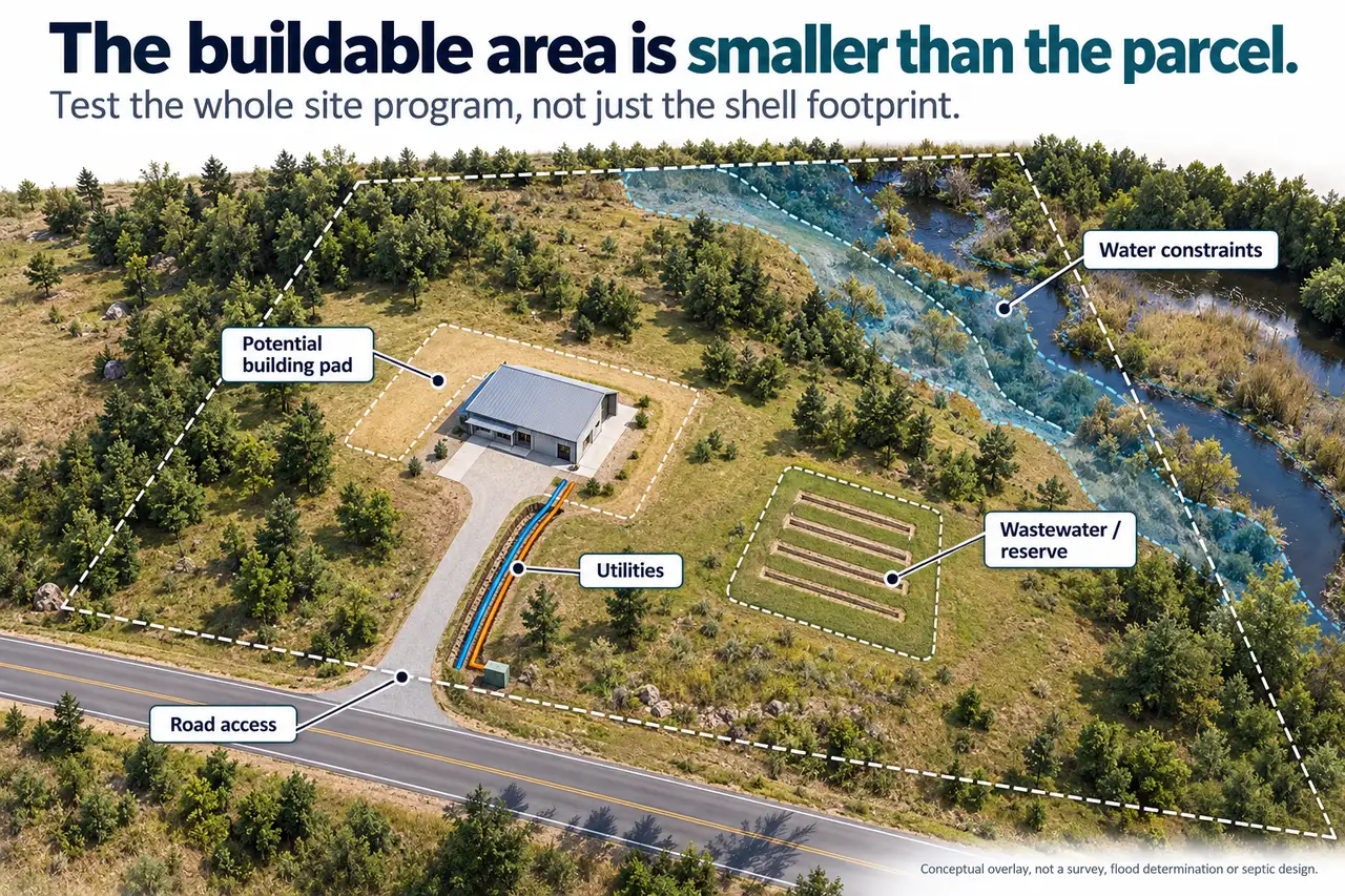
Verify utilities, water and wastewater as complete service paths
For each service, identify the provider, connection point, available capacity, route, approvals and responsibility for the work. Electricity at the road is not the same as confirmed service to the proposed building. A nearby water line does not establish the right or capacity to connect. Ask the provider what information it needs about household and shop demand and obtain a response tied to the actual parcel and proposed use.
If a private water source is proposed, ask the qualified local professionals and relevant authority about feasibility, required evaluation and the process for establishing suitability. Do not infer water quantity or quality from a neighboring well or a seller statement. Coordinate the water-source location with wastewater, building and access plans using locally applicable separation and protection requirements, rather than applying a generic distance from an online article.
Oregon DEQ's residential septic guidance describes site evaluation of soil, groundwater and constraints in proposed initial and replacement treatment areas, and cautions that evaluation does not guarantee approval of a specific system. This is an Oregon permitting example. Ask the actual local wastewater authority what evaluation and approvals apply to the parcel and what the proposed sleeping-room program means for the design.
Treat wastewater planning as a site-layout decision before the home location is fixed. Identify any required replacement area, maintenance access and restrictions on other uses of the area. A septic tank outline alone does not represent the whole system. Confirm where treatment and dispersal occur, how the house connects and what site conditions the designer needs to evaluate. Keep future bedroom or occupancy changes visible in that discussion.
Add internet and other household services to the same evidence ledger if they are important to living or working at the property. Ask about service availability at the building location rather than assuming an area coverage map resolves it. The goal is to identify the complete path from provider or onsite system to the intended use. Mark dependencies and unanswered requests so they remain part of the purchase decision.
Worked example: gross acreage hides a constrained arrangement
Consider a hypothetical rectangular parcel with an attractive clearing near the road. The buyer initially places the home and shop there because the shell fits comfortably inside the visible property outline. Further investigation identifies an access easement, a drainage route and an area being evaluated for wastewater treatment. No universal setback or assumed approval is assigned in this example. Each constraint must come from the actual survey, documents, authority or qualified site evaluation.
The buyer creates four transparent overlays: boundary and recorded interests; physical site conditions; access and utilities; and proposed buildings plus wastewater areas. Viewed separately, each layer seems manageable. Viewed together, the preferred shop approach crosses the proposed treatment area, while the initial home location leaves little practical room for the required service arrangement. The conflict is spatial, so a total-acreage figure does not resolve it.
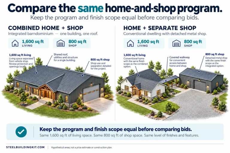
Compare two concepts. In the first, move and rotate the combined building while preserving the household and shop program. Ask whether that improves the driveway approach and keeps the evaluated wastewater area available. In the second, reduce or separate functions to fit a different portion of the parcel. Both concepts remain conditional until the responsible professionals confirm the routes, approvals and physical feasibility. A buyer sketch cannot establish the final solution.
Add an evidence column beside each concept. A confirmed boundary may support a precise placement reference, while a provider inquiry still leaves a utility route unresolved. A preliminary soil evaluation may narrow the wastewater options without constituting an installation permit. Label those statuses honestly. The preferred concept is the one that can become supportable through the remaining process, not simply the one drawn with the fewest warning symbols.
The example produces a decision rule: choose land based on a coherent, evidence-supported arrangement of all required functions. If the arrangement depends on an uncertain permission, route or treatment area, that uncertainty belongs in the purchase discussion. Work with appropriate real-estate and legal professionals on the contract implications; this guide does not supply legal contingency language or guarantee a right to cancel a purchase.
A parcel-specific due-diligence package before commitment
Keep a compact folder containing the parcel identification, survey and title information, use description, authority responses, provider responses, site concept and open questions. Record dates and the version of the project described. A response about a small personal shop may not resolve a later plan for a business or larger dwelling. Update the inquiry when the intended use changes rather than relying on an earlier answer outside its scope.
How much land is enough? The answer depends on the locally permitted uses, required site functions and the shape and constraints of the parcel. A smaller parcel with suitable service and access may work better than more acreage with unresolved restrictions or physical conflicts. Determine adequacy from the arrangement and evidence rather than a universal minimum-acreage rule.
Should you buy the land before choosing the exact floor plan? You can start with a realistic room and shop program and a few candidate footprints, then adapt the design to the verified site. Freezing the exact shell before understanding the envelope can create avoidable conflicts. Conversely, a parcel inquiry without any description of building size or use may be too vague to answer the important questions. Develop the two together until the major dependencies are clear.
What is a stop condition? For this planning method, it is an unresolved fact capable of preventing the intended project: uncertain lawful access, an unconfirmed use, an infeasible wastewater arrangement or a service requirement the buyer cannot accommodate. It is a prompt to investigate or reconsider, not an automatic legal conclusion about the parcel. Distinguish these issues from preferences that can be traded or redesigned.
Use the steel building buyers guide to connect land findings with supplier and project commitments. The metal building layout library can help test candidate arrangements once the site envelope is clearer. Before buying land for a barndominium, the practical next step is to resolve the parcel-specific dependencies with the people authorized to answer them and retain the evidence supporting the intended project.